
N° 1 January 2019
Technology and transport: the two 2019 keyworDS
Industry 4.0, Blockchain, Artificial intelligence, support for green mobility, technological monitoring of infrastructures and goods flows, restyling of the road code. These should be the key words to understand what will happen in 2019 in the world of transport and technology. Many of these inputs come from the budget law passed on December 30th, others are already contextualized in other measures or emerge from parliamentary work. Let's look at the various aspects in detail.
Industry 4.0
The budget law contains several innovations. In fact, the hyper-depreciation for investments has been extended for goods functional to the technological and/or digital transformation of companies in key Industry 4.0. The cost increase is applied in the amount of 170% for investments up to 2.5 million euro, 100% if between 2.5 and 10 million euro and 50% if between 10 and 20 million euro. No increase is granted over 20 million euros. Also confirmed the increase of 40% of the cost for the acquisition of software, while the benefit is extended to the costs incurred for access to the cloud. Many financing solutions, including some applicable to the supply chain. The tax credit for the training of employees in the technology sector has also been renewed. The voucher for the Innovation Manager is introduced in order to support the technological and digital transformation processes.
Blockchain and Artificial Intelligence
A theme of high relevance for the Government that has established two working groups composed of experts on these issues to develop the national strategy to be sent to the EU. A strategy also supported by the budget law which provides for the establishment of a fund for interventions aimed at encouraging the development of technologies of artificial intelligence, blockchain and IoT - Internet of things. The budget is expected to be 15 million euro for each year from 2019 to 2021. Also included in the budget law are funds for cybersecurity to enhance cyber defense interventions and tools, as well as to "strengthen the capacity for national energy resilience", with a budget of one million euros for each year from 2019 to 2021 in favor of the Ministry of Defense.
Green mobility
Bonus up to 6 thousand euros for the purchase of electric and hybrid cars. This is the novelty introduced by the budget law 2019. Incentives, introduced on an experimental basis, will be valid for the years 2019, 2020 and 2021, with a contribution between 1,500 and 6,000 euros for those who purchase vehicles characterized by low polluting emissions, lower than 70 g / KM, therefore substantially for totally electric or hybrid vehicles. The amount of the contribution is differentiated on the basis of two emission bands and the circumstance for which the purchase takes place. The budget law provides for a new tax deduction for the purchase and installation of charging infrastructure for vehicles powered by electricity. The deduction is equal to 50% of the expenses incurred from 1 March 2019 to 31 December 2021, calculated on a total amount not exceeding 3 thousand euro and divided into ten annual installments of the same amount. For the payment of the contribution a special fund is set up at the Ministry of Economic Development, with a budget of 60 million euros for 2019 and 70 million euros for each of the years 2020 and 2021.
The electric and hybrid vehicles will also have free access in limited traffic areas. This measure is also presented in an experimental form and is accompanied by the allocation of 2 million euro in 2019 for the creation of cycling motorways. Lastly, as regards local public transport, 145 million over three years are foreseen in the budget law (55 in 2019, 65 million in 2020 and 25 in 2021) for the upgrading and extraordinary maintenance of the three metro lines in Rome. In Milan, 900 million in 9 years for the extension of the metro line 5 (M5) to the town of Monza.
Technological monitoring of infrastructures and goods flows
2019 will be a very important year for upgrading infrastructure security. The actions following the collapse of the Morandi bridge, contained in the Genoa decree, bring various technological innovations. Firstly, the establishment of the national computer archive of public works (AINOP), at the Ministry of Infrastructure and Transport, divided into sections and subsections, for specific public works. The archive will contain, for each work, the technical data, the status and the degree of efficiency, the ordinary maintenance activity and the status of the works. Furthermore, the same decree introduces an experimental system of dynamic monitoring for road and motorway infrastructures that present critical conditions connected to the passage of heavy vehicles. At the end of the experimental phase, the dynamic monitoring system is expected to be fully operational, implemented through the use of the most advanced and effective technologies (5G), including space technologies, for the acquisition and processing of data of interest. For the financing of these projects a fund of € 2 million is set up. Furthermore, 2019 will also be remembered for the abolition of SISTRI, the telematic system for monitoring waste streams, repealed by the simplification decree starting from 1 December 2018. The text, currently under consideration by Parliament, also provides that the Ministry of the Environment works on another system for digital monitoring of goods flows.
A new road code
At the end of the legislature, the two decrees discussed in Parliament for a new road code have lapsed, but the Transport Commission of the Chamber of Deputies has just begun to dust off the file by merging a series of decrees on the subject. The work on the road code is then opened, hoping that this time will be better.

This Month Focus On...
Member of the month
TTS Italia partners
TTS in action
Save the date
ITS relevant tenders in Italy


ESRI Italia
 Esri Italia is the company leader in the Italian market for geolocalized solutions and is part of the large international network of Esri Inc-CA USA. It supports agencies and companies in complex geospatial analysis and spreads the power of geographic information reading within organizations.
The company’s vision is represented by the brand “The Science of Where”, a fundamental language to understand and analyze phenomena on a territorial basis and to get all the opportunities offered by the digital revolution: IoT, Big Data, Machine Learning and AI can not prescind without integration with the geographical component.
Esri Italia offers software technologies and solutions dedicated to numerous market sectors, from Public Administration to Energy, from Natural Resources to Telecommunications, from Transports to Trade. Furthermore, it supports the world of Universities, Research Institutions and the No Profit sector.
As for the transport sector, the tools made available by Esri technology are used for many purposes, from modeling transport requests, to tracking vehicles route, analyzing annual investment plans, identifying violations to noise legislation in areas around airports. All the transport sectors benefit from the solutions offered by Esri: public transport, road transport, railways, air transport, shipping and logistics.
PRODUCT IN THE SPOTLIGHT
ArcGIS Platform
 The ArcGIS Platform allows you to create, integrate and share maps, applications and data, to coordinate the work of people within an organization, bringing technological innovation into its business and considerably improving decision-making processes.
The ArcGIS Platform is the solution chosen by local administrations, industrial groups, non-governmental organizations and major companies all over the world to exploit and enhance the power of geographic information.
The ArcGIS Platform allows you to create, integrate and share maps, applications and data, to coordinate the work of people within an organization, bringing technological innovation into its business and considerably improving decision-making processes.
The ArcGIS Platform is the solution chosen by local administrations, industrial groups, non-governmental organizations and major companies all over the world to exploit and enhance the power of geographic information.
Accessible anywhere, from any type of device, at any time, the platform allows to use performance indicators, analyze trends and spatial connections that affect business operations, evaluate assets, obtain information in real time, study patterns and dissemination of phenomena on the territory, obtaining new useful information.
One of Esri's latest developments - coming up in the coming months - is ArcGIS Indoors: an interactive solution that provides information for monitoring and analysis of large corporate buildings, commercial offices, airports, hospitals, sites dedicated to hosting events, university campuses , etc.
ArcGIS Indoors allows you to create, share and apply maps to increase productivity and facilitate the management of more complex operations. Combining internal cartographic information with navigation, planning and analysis, ArcGIS Indoors processes 3D maps, data and location information in real time.
The solution also includes tools to help optimize space management, so that managers and operators can work more efficiently and competitively. ArcGIS Indoors allows you to bring the interior space of buildings into the future by entering data on employees, schedules, meetings, customers and events in a geographical context.
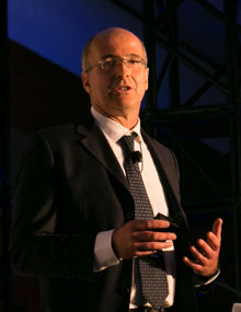
INTERVIEW TO...
Michele Ieradi – Solutions Director Esri Italia
In relation to the management of critical infrastructures, sadly topical in recent months, what is the role of GIS? And how does this integrate with BIM?
Remaining in the context of critical traffic infrastructure, the most current theme is monitoring and prevention. The GIS is central to both of these issues because it is a tool for collecting data from different sources and producing summary informations useful for taking decisions. Information from drones, static sensors, dynamic sensors, satellite images, cameras and many other tools can be the source of a more complex structural analysis that allows you to check the health status of a critical infrastructure (monitoring) and eventually qualify the type ordinary and / or extraordinary maintenance that should be carried out to avoid future problems (prevention).
Monitoring could be carried out through the continuous analysis of millimeter displacements of critical infrastructures starting from minimally invasive systems, such as a network of GPS sensors and satellite radar images of the Cosmo Skymed system. The engine of this system should be a GIS integrated with Machine Learning procedures that are adequately configured to be able to identify the anomalies found in the detected movements (alarms). These anomalies could be verified and managed through specific inspections with appropriate equipment (Lidar sensors, Drones, IoT, etc.). The management process could be integrated and enriched by other data from different sources, such as Ispra, Geological Service, National Cartographic Portal, Regions, etc. The result would be not only the management of the alarms, but also the assessment of the impact on the general and local roads of each individual intervention.
The operational flow is clear, but to implement it, it is necessary a decision-making phase of a higher level that allows the definition of a monitoring process no longer based on periodic inspections, but on a national system for monitoring critical infrastructures that through analysis continuous information described is able to automatically detect alarms and suggest intervention plans.
In recent years, thanks to the integration between the GIS and BIM systems, GIS has also become important in the operational management of critical and non-critical infrastructures.
In fact, the BIM manages the entire life cycle of the work: the design, construction, maintenance until decommissioning, and uses GIS data along the entire operating flow. The information coming from the GIS can be used in the BIM workflow during the design phase (for example, to contextualize the work in the territorial area) or to inform citizens about the construction of the infrastructure in an Open BIM key.
The contextualization of the work allows to strongly improve the adherence of the construction parameters of the critical infrastructure to the real environmental stresses (for example, possible extreme weather conditions of the area and anthropic, such as the flow of vehicles) to which the work will be subjected. The combination of the GIS and BIM workflows also makes it possible to greatly improve the performance of site logistics in terms of procurement, disposal of materials and calculation of the impact on local vehicle traffic.
Finally, the application of BIM models to artefacts created in periods prior to the advent of this technology, will allow verification of the static and dynamic safety of the works according to current use and not planned at the time of construction, highlighting the possible critical issues, through simulation systems and the use of information from the GIS (vehicle flow, data on weather events, etc.). The GIS, also by virtue of the recent integration with BIM systems, has and will increasingly play an important role in monitoring and preventing risks related to the management of critical infrastructures and in communication with citizens / users.
Several Italian cities are defining plans for electric mobility for commercial and private vehicles. How can the Science of Where support this change process?
The electric mobility of goods and people is now a reality even in Italian cities. In our cities we are increasingly seeing electric vehicles of different types transporting people or goods (cars, bikes, scooters, scooters, etc.) and we often ask ourselves where and how often these vehicles are recharged.
This is a real innovation of the mobility paradigm whose technological assumptions (battery life, quantity and quality of charging points) must be tackled in a structured way through partnerships / local agreements between public administration and private individuals.
The involvement of the Administrations is central to start the process. As is known, in fact, electric mobility without specific interventions does not solve the problem of air pollution, but simply shifts and concentrates urban pollution in places where electricity is produced. Therefore, to address the problem of pollution in a structured manner, measures should be implemented to encourage the production of electricity from renewable sources.
But in all this how does the The Science of Where support the process?
First of all, the GIS is fundamental for defining the plan for the positioning of charging stations and relative stalls for electric cars according to the needs of the citizens, the urban limits and the existing electricity grid. In this sense, a virtuous example of the ideation of a participative decision-making process is the web questionnaire (on Esri maps) created by Roma Servizi for Mobility that allowed to know where are the places where Roman citizens would like the recharge columns to be installed: https://romamobilita.it/it/punti-di-ricarica-elettrica-proponi-dove-posizionarli.
IThe GIS, therefore, was used to weigh the different parameters (citizens' requests, the electricity grid and urban planning restrictions) and to define the best possible position for top-up points / stalls. GIS is used to define urban areas to prohibit access to non-electric vehicles. Moreover, in consideration of the current limits of autonomy of electric cars and motorcycles, in the extra-urban environment the GIS is useful to define a charging network that considering the consumption by type of road and slope map allows free circulation of electric vehicles even between distant cities. The GIS is also able to provide the geographical information that car navigation systems of electric cars can use to correctly calculate the residual autonomy in relation to the chosen route, the type of asphalt, slopes, etc.
The traditional route calculation tools (google map, waze, moovit, etc.) seem to get increasingly inadequate to the requests of users who want to be guided not only along the external route (roads, railways, etc.) but even inside train stations and airports. So is there a solution that allows you to plan outdoor and indoor routes?
Now each of us has delegated to his smartphone the task of guiding him from one place to another for daily travel. Yet, google map exists only since 2005 and before 2010 there were no smartphones for all budgets powerful enough to guide us step by step on an intermodal path. So this revolution took place in just 8 years and it is not over yet. We have been unaware actors of this revolution because one of the main "ingredients" of the mentioned route calculation applications are the data coming from our smartphones. GPS data from our smartphones analyzed by complex Machine Learning algorithms and GIS enterprise systems generate information on the presence / absence of roads, traffic, accidents, parking availability, events, etc. These new services allow us to have in our pockets a real support system for decisions relating to individual mobility. Today we are able to evaluate, in a few seconds, not only the best route, but also the combination of transport modes that best meets our needs.
The new frontier of the sector is the possibility of being guided in outdoor and indoor environments in a continuous manner. For example, from an airport gate to a railway station platform. In fact, from the point of view of application there are no specific barriers, however, to date no application exists that allows this service to be provided. But what are the barriers to this type of application? The main barriers are: the availability of indoor environments maps and indoor positioning tools. There are no complete commercial databases of public and / or private indoor environments. The different players (Google, Here, Tom Tom, etc.) are acquiring information, but the databases are not yet complete and there is no standard format for this type of information. The situation concerning indoor positioning systems is even more complex: there is no standard of positioning (wifi, bluetooth, rfid, etc.) and there is no service provider like in the case of outdoor positioning (the GPS system).
In the coming months, Esri will launch a solution called ArcGIS Indoors that allows you to create data for the indoor pedestrian network, update and even manage automatically the information relating to objects (for example, an information box of a train station equipped with a beacon bluetooth that communicates its position at each move) and allow consultation of 3D maps of buildings and calculate the multimode and multi-storey route. In fact, a complication of indoor navigation is the need to represent moving across different floors of different buildings and therefore the need for a 3D x-ray representation (see through buildings). The system can be integrated with other route calculation systems and allows the use of BIM models for the acquisition of information relating to buildings. The solution ArcGIS Indoors intends to meet the general requirement of the guide to moving in indoor environments, also needs such as access control, building safety, personnel management, asset management, plant maintenance, etc.
Consortium of Kapsch TrafficCom and CTS EVENTIM officially commissioned to collect German passenger vehicle toll
The German Federal Ministry of Transport and Digital Infrastructure as the responsible contracting authority today officially commissioned a consortium consisting of Kapsch TrafficCom AG, TTS Italia ordinary member, and CTS EVENTIM AG & Co. KGaA with the collection of the German passenger vehicle toll (‘Pkw-Maut’). After none of the unsuccessful bidders had made use of their legal protection rights under public procurement law, the client and contractor sealed their cooperation by notarization today.
Kapsch TrafficCom and CTS EVENTIM had taken part in the EU-wide tender for this project as a bidding consortium. The operating company is to be a joint venture in which each company will hold an equal, 50-percent stake, and which both companies expect to consolidate at equity.
The contract between the Federal Republic of Germany and the operating company has a base term of twelve years starting with the first collection of the infrastructure charge. For the operating company (i.e. the joint venture), the total contract volume throughout the minimum term of the contract amounts to almost EUR 2 billion (including VAT). The principal can extend the contract once for three years, or three times by one year (hence, up to a total term of 15 years).
Source: Kapsch
Kapsch TrafficCom secures new contracts for Tolling Roadside Systems in Australia
Kapsch TrafficCom Australia Pty Ltd has has been contracted by the CPB Contractors John Holland Joint Venture (CPBJH JV) to deliver the Tolling Roadside System for the West Gate Tunnel Project (WGTP) in Melbourne. The second project has been contracted by the Lendlease Samsung Bougyues Joint Venture (LSB JV) to deliver the Tolling Roadside System for Stage 3A of the WestConnex Program, the M4-M5 Link Main Tunnel Works Project in Sydney. The scope of both contracts comprises design, supply, installation and commissioning of the roadside tolling system for these two significant road infrastructure projects. The total value is above EUR 20 million.
WestConnex M4-M5 Link Main Tunnel, Sydney: For the M4-M5 Link Main Tunnel Works project, Kapsch will deliver LSB JV and, ultimately, the WestConnex Stage 3 motorway operator Sydney Motorway Corporation, the latest cutting-edge tolling technology based on the company’s single gantry multi-lane free-flow (MLFF) platform and next-generation stereoscopic vision technology for both Vehicle Detection and Classification (VDC) and Automatic Number Plate Recognition (ANPR). The WestConnex Program of motorway projects is part of an integrated transport plan for Sydney – easing congestion, creating jobs and connecting communities. Once completed, the new motorway will provide crucial support for Sydney’s long-term economic and population growth.
West Gate Tunnel Project, Melbourne: For the West Gate Tunnel Project, Kapsch will deliver the latest cutting-edge tolling technology based on the company’s single gantry multi-lane free-flow (MLFF) platform and next-generation stereoscopic vision technology for both Vehicle Detection and Classification (VDC) and Automatic Number Plate Recognition (ANPR). The project will deliver a vital alternative to the West Gate Bridge, providing a much needed second river crossing for the city of Melbourne, quicker and safer journeys, and remove thousands of trucks from residential streets.
„Almost 20 years ago Kapsch delivered the world’s first multi-lane free flow tolling system in Australia. We are pleased to further expand on the strong partnerships we built over the years and to be playing a crucial part in such important projects again,“ says André F. Laux, Chief Operating Officer at Kapsch TrafficCom.
Source: Kapsch
Kria wins tender for speed control
Kria, TTS Italia ordinary member, has won the tender issued by the Municipality of Milan for the supply and installation of 10 new speed control devices.
Source: TTS Italia
New Anas’ project: columns for electric cars on motorways
Anas, a TTS Italia supporting member, has started the project for the installation of charging stations for electric cars in the service areas of motorways operated on the national territory. The project started with the publication of calls for tenders for the assignment of service area concessions that provide for the fast electric recharging points on the A2 'Autostrada del Mediterraneo', on the A19 'Palermo-Catania' and in 10 service areas along the A90 'Grande Raccordo Anulare di Roma' and A91 'Rome-Fiumicino Airport' motorways.
Currently, the recharge service is already available at the service area of Selva Candida Esterna of Rome's Grande Raccordo Anulare, one of the busiest arteries in Italy with peaks of 168,000 vehicles a day.
The electric recharging service on the GRA of Rome and Rome Fiumicino completes a path that falls within the "Plan to rationalize the network of motorway service areas and which Anas , two years ago, with the aim of extending the service in all the service areas entrusted in concession along the motorway network managed by Anas (a total of 41 plants).
The calls for the "Oil" service include, alongside traditional fuels (petrol, diesel), that the concessionaires also provide the fast electric recharging of vehicles in all service areas as well as the supply of LPG and methane (the latter where technically feasible).
In particular, as regards the electric recharging service, provision is made for "multi-standard" columns that combine industrial standards and high power charging technologies. These modes of energy supply guarantee the compatibility of the service with all the cars currently on the market and of next generation. The charging stations will also be equipped with modems for connection to management software, payment platforms or network management systems according to the "smart grid" function. The technology adopted will make the charging stations reliable, safe, economical and will ensure standard interface protocols and accessible to all.
Source: Strade & Autostrade
Project Automation wins three new tenders
Project Automation, TTS Italia ordinary member, has won the tender issued by the Municipality of Pozzuoli for supply of an automatic system to control access to limited traffic areas of the Municipality of Pozzuoli itself. Project Automation also won the tender issued by the Municipality of Sava (TA) for the rental, installation, ordinary and extraordinary maintenance of n. 4 fixed automatic devices to detect traffic offenses. Finally, Project Automation was also awarded the tender issued by the Single Central Commission of the Municipalities of Rapallo and Camogli - Municipality of Rapallo for the service of maintenance of the urban video surveillance system for a period of 60 months, possibly extendable for a further 36 months. Source: TTS Italia
STMicroelectronics partner for an EU integrated project on microelectronics
The European Commission has found that an integrated project jointly notified by France, Germany, Italy and the UK for research and innovation in microelectronics, a key enabling technology, is in line with EU State aid rules and contributes to a common European interest.
STMicroelectronics, TTS Italia ordinary member, is among the partners, representing Italy.
The four Member States will provide in the coming years up to €1.75 billion in funding for this project that aims to unlock an additional €6 billion in private investment. The project should be completed by 2024 (with differing timelines for each sub-project).
On 30 November, France, Germany, Italy and the UK jointly notified to the Commission an Important Project of Common European Interest ("IPCEI") to support research and innovation in microelectronics. Microelectronics are small electronic components usually made of semiconductor materials such as silicon. The basic microelectronic components, commonly known as chips and sensors, can be found in almost all electronic devices.
The integrated research and innovation project will involve 29 direct participants, headquartered both in and outside the EU. They are mostly industrial actors but also two research organisations, carrying out 40 closely interlinked sub-projects.
These direct participants will work in collaboration with a large number of partners, such as other research organisations or small and medium-sized enterprises (SMEs), also beyond the four Member States.
The project's overall objective is to enable research and develop innovative technologies and components (e.g. chips, integrated circuits, and sensors) that can be integrated in a large set of downstream applications. These include consumer devices, for example home appliances and automated vehicles, and commercial and industrial devices, for example the management systems for batteries used for electric mobility and energy storage.
In particular, the project is expected to stimulate additional downstream research and innovations in particular in relation to the broad area of the Internet of Things and to connected or driverless cars.
The project participants and their partners will focus their work on five different technology areas:
(1) Energy efficient chips: developing new solutions to improve the energy efficiency of chips. These will, for example, reduce the overall energy consumption of electronic devices including those installed in cars;
(2) Power semiconductors: developing new technologies of components for smart appliances as well as for electric and hybrid vehicles, to increase the reliability of final semiconductor devices.
(3) Smart sensors: working on the development of new optical, motion or magnetic field sensors with improved performance and enhanced accuracy. Smart sensors will help improve car safety through more reliable and timely reaction to allow a car to change lanes or avoid an obstacle:
(4) Advanced optical equipment: developing more effective technologies for future high-end chips; and
(5) Compound materials: developing new compound materials (instead of silicon) and devices suitable for more advanced chips.
All five technology fields are complementary and interlinked – chips are not typically sold by themselves but are often supplied as part of an integrated system. Such systems require a combination of processes and technologies covered by the different fields of the project. For this reason, the project participants will be involved in over 100 collaborations across the different areas in the 40 closely interlinked sub-projects.
Source: European Commission
Viasat signs partnership with ANAPA: doors opened to insurance intermediaries
VIASAT S.p.A. - European excellence in satellite infotelematics systems and ordinary member of TTS Italia - and ANAPA Rete ImpresAgenzia - the National Association of Insurance Professional Agents - have signed an important collaboration agreement, aimed at the diffusion of added value telematic services that will allow intermediaries insurance companies to build tailor-made solutions and offer greater freedom of choice to their customers, through products and services strictly Made in Italy.
Today, telematics plays a central role in the insurance offer, but it is still too tied to the discount on the TCA coverage and to the anti-fraud purposes of great interest for the Companies, often forgetting the great opportunity it represents in terms of useful services and added value. that can be appreciated by the insured. From these premises the collaboration between Viasat and ANAPA Rete ImpresAgenzia is born to make available to insurance intermediaries the 'Sicuri & Protetti' offer which provides a range of technological assistance, protection and security solutions, thanks to the Viasat H24 Operations Center, combined with any car insurance. For the insured, in addition to the services of Viasat, also the certainty of having full and rigorous control over their data which, at the time of the GDPR, assumes an even greater importance.
Source: Viasat
Vitrociset awards a tender for tunnel monitoring
Vitrociset, TTS Italia ordinary member, was awarded the tender issued by Azienda Trasporti Milanesi S.p.A. for the on-site supply, including the design and commissioning, of a monitoring system with video thermal analysis, to monitor the accesses in the MM tunnels.
Source: TTS Italia
TTS Italia in Montecitorio for the presentation of the Report on technological innovations and mobility governance
SIPOTRA (Italian Society of Transport Policy) organized the presentation of the 2018 Report "Technological innovations and mobility governance" on 30 January at Palazzo Montecitorio.
The purpose of the Report is to put together, with reference to transport, the many fronts that are the subject of technological, organizational and mobility styles, their possible impact, the potential impact on well-being. The book aims to go beyond the pure, aseptic, recognition of the current state of the art of technological innovation and changes in the demand for mobility, tracing trend lines with multiple possible scenarios, analyzing possible critical issues, arguing that the benefits that they can be derived not only from the spontaneous course of the markets but largely from the public government, at all levels, of the innovative process. Finally, by formulating proposals, on the many sides open to change: institutional, programmers, financial, regulatory and competition.
TTS Italia, represented by President Rossella Panero, discussed innovation and mobility governance, together with: President of the Astrid Foundation; Chairman of the Transport Regulatory Authority; Polytechnic University of Turin; Foundation for Sustainable Development; President of the National Council of Economy and Labor.
TTS Italia at the conference "PUMS - Urban Plan for Sustainable Mobility" in Verona
On Friday, January 18, 2019, in Verona, TTS Italia ordinary member, at the Palazzo della Gran Guardia, the Conference dedicated to PUMS (Urban Plan for Sustainable Mobility) took place The Municipal Administration decided to set up a winning strategy for the development and mobility in the urban area of the city of Verona.
The event, organized by the Traffic and Traffic Department of the Municipality of Verona, is one of the initiatives that the Municipality of Verona intends to launch to obtain maximum visibility on the PUMS, particularly significant for the production and socio-economic reality, and to involve immediately the population and the productive categories, as foreseen in the Guidelines on the formation of the same issued by the Ministry of Infrastructures.
It was an important opportunity to outline future strategies on urban mobility in Verona and beyond.
The working day saw the succession of institutional and technical interventions. In particular, TTS Italia, represented by the General Secretary Eng. Landolfi, took part in the event with the speech on "The role of ITS in the PUMS".

Transpotec Logitec
21-24 February 2019, Verona
For further information, click here

6th ITS CMS Plugtests
25 February -1 March 2019, Sophia Antipolis, France
For further information, click here
Per tutti i bandi clicca qui
Italia – Bari: Videosurveillance system
Italia-Settimo Torinese: Services for parkings management
Italia-Trento: Software for personal and economic transactions
388, Flaminia street 00196 Rome
|
TTS Italia informs that data are used in the respect of the
GDPR 2016/679
Click here for further information.